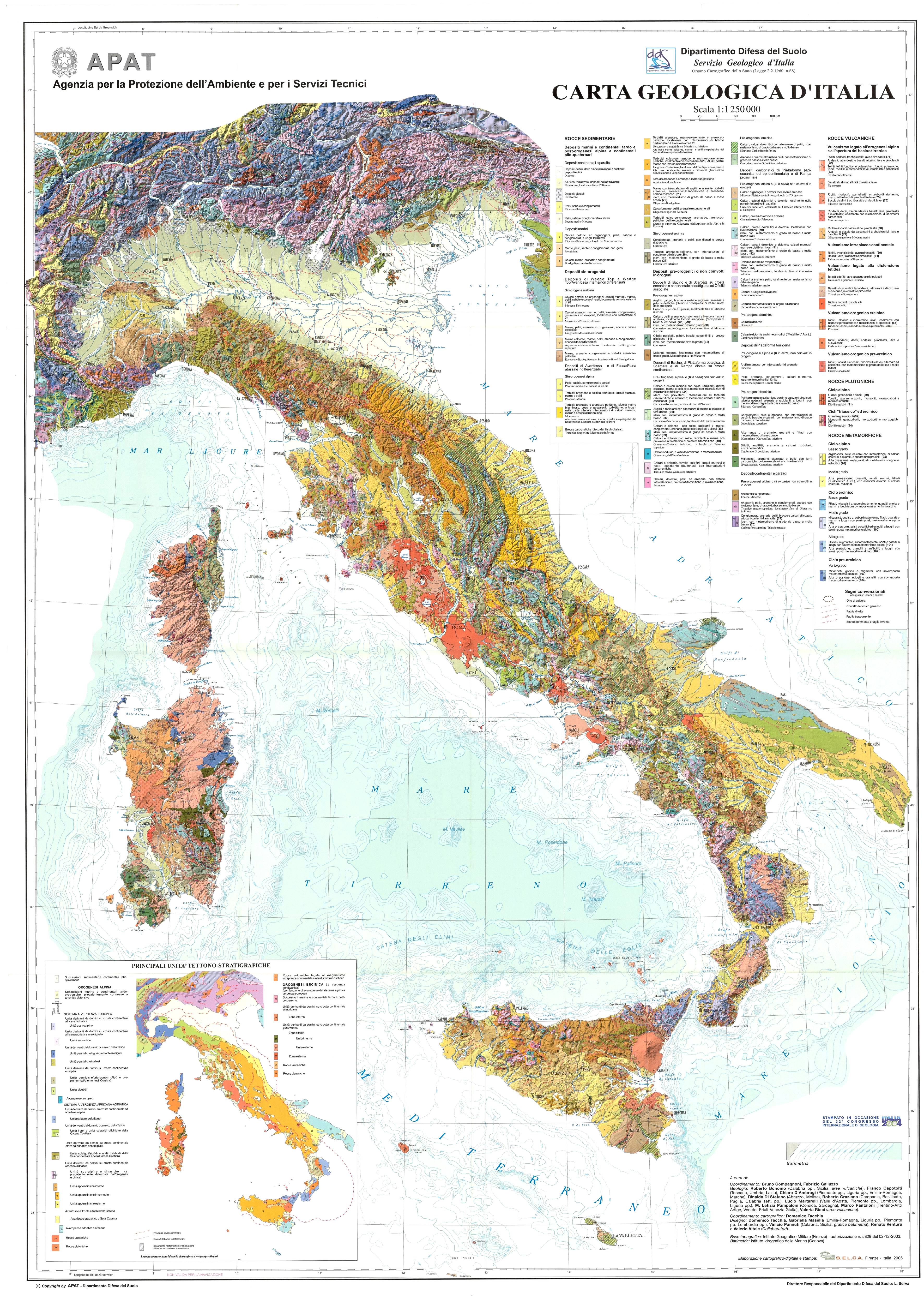
ITA_Carta_Geologica_raster_1:1250k_DT
URL: http://www.isprambiente.gov.it/images/progetti/progetto-1250-ita.jpg
From the dataset abstract
Il dataset in formato raster relativo alla Carta Geologica d'Italia alla scala 1:1.250.000, edita dal Servizio Geologico d'Italia (APAT oggi ISPRA) nel 2005, e stato realizzato dalla...
There are no views created for this resource yet.
Additional Information
| Field | Value |
|---|---|
| Data last updated | August 11, 2018 |
| Metadata last updated | August 11, 2018 |
| Created | August 11, 2018 |
| Format | JPEG |
| License | CC-BY-SA |
| created | over 5 years ago |
| format | JPEG |
| id | 4140d9e3-b0f3-41fb-ad00-6dbee9092ea8 |
| package id | 4854c4d1-8f50-4597-a3f6-e03255690f79 |
| position | 1 |
| revision id | 6762627d-293a-40ed-8aaa-a6198d7527b8 |
| size | 3 MiB |
| state | active |