PIN
Service
Digital Platform
Neo geography
Industry
Environment
Emergency management goes digital
Client issues
- Difficulty in uniformly monitoring interventions managed by different entities on a national scale.
- Lack of interoperability between public databases (BDAP, SIMOG, SIOPE+, CUP).
- Heterogeneous document flows (Excel, PDF) that slow down decision-making processes and transparency
- Need for a digital tool to aggregate, validate, and communicate data in a standardized and georeferenced manner.
Our solutions
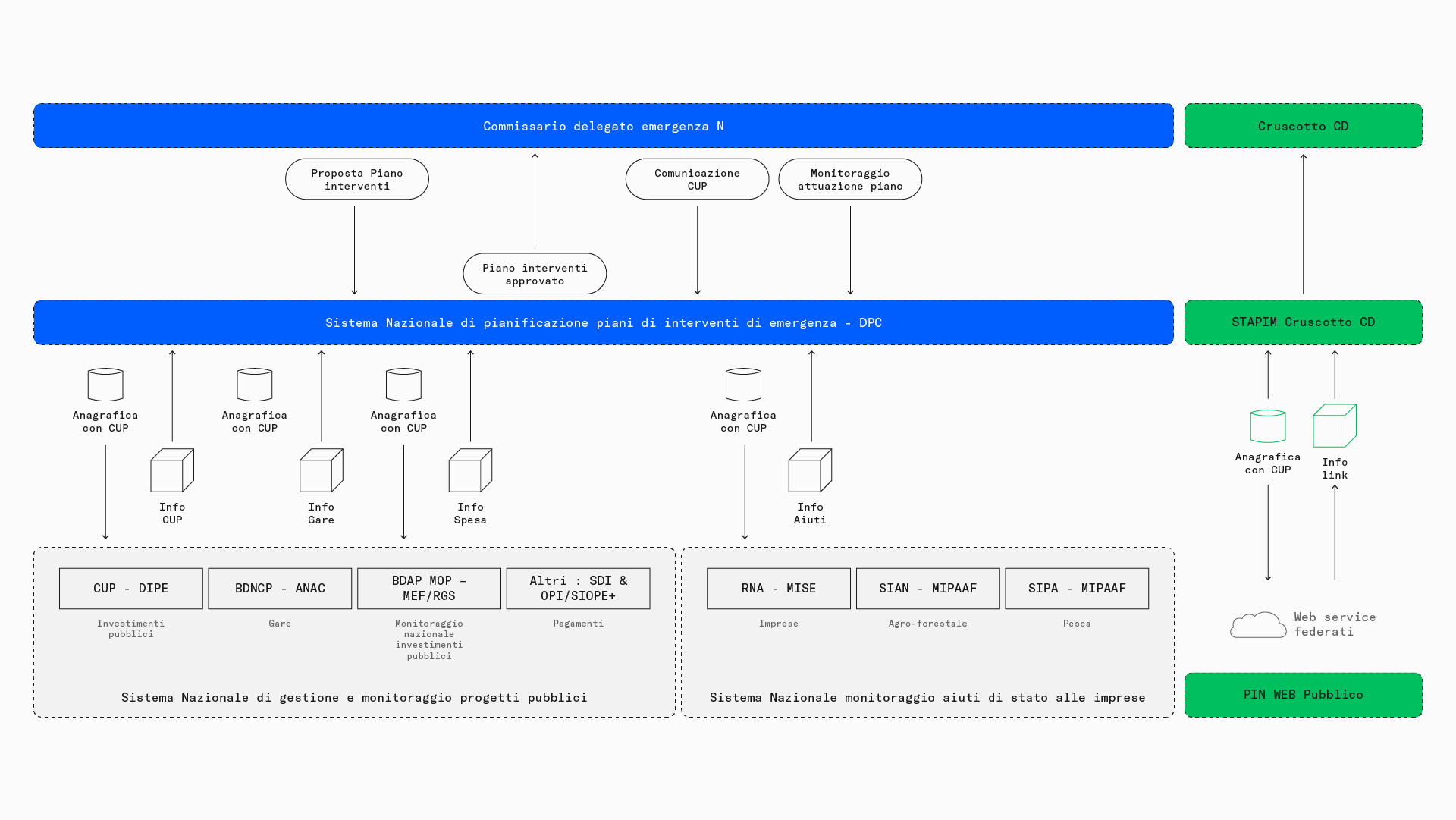
- Design and development of the platform, integrated with the main national systems via API and REST services.
- Definition of a shared data model, with a unique identification code for each intervention.
- Automatic integration of data from institutional sources to reduce manual entry.
- Intuitive mapping interface and tools for analysis, reporting, and tracking updates.
The project
PIN was created as part of the ProteggItalia plan with the aim of improving the governance of emergency response operations. The project involved collaboration between SciamLab, the Department of Civil Protection, the Politecnico di Milano, and numerous national agencies. SciamLab oversaw the entire process: process analysis, UX/UI design, platform development, and support for the digital transition of the agencies involved. The system was designed to adapt to an evolving regulatory environment and to gradually accompany implementers towards digitization.
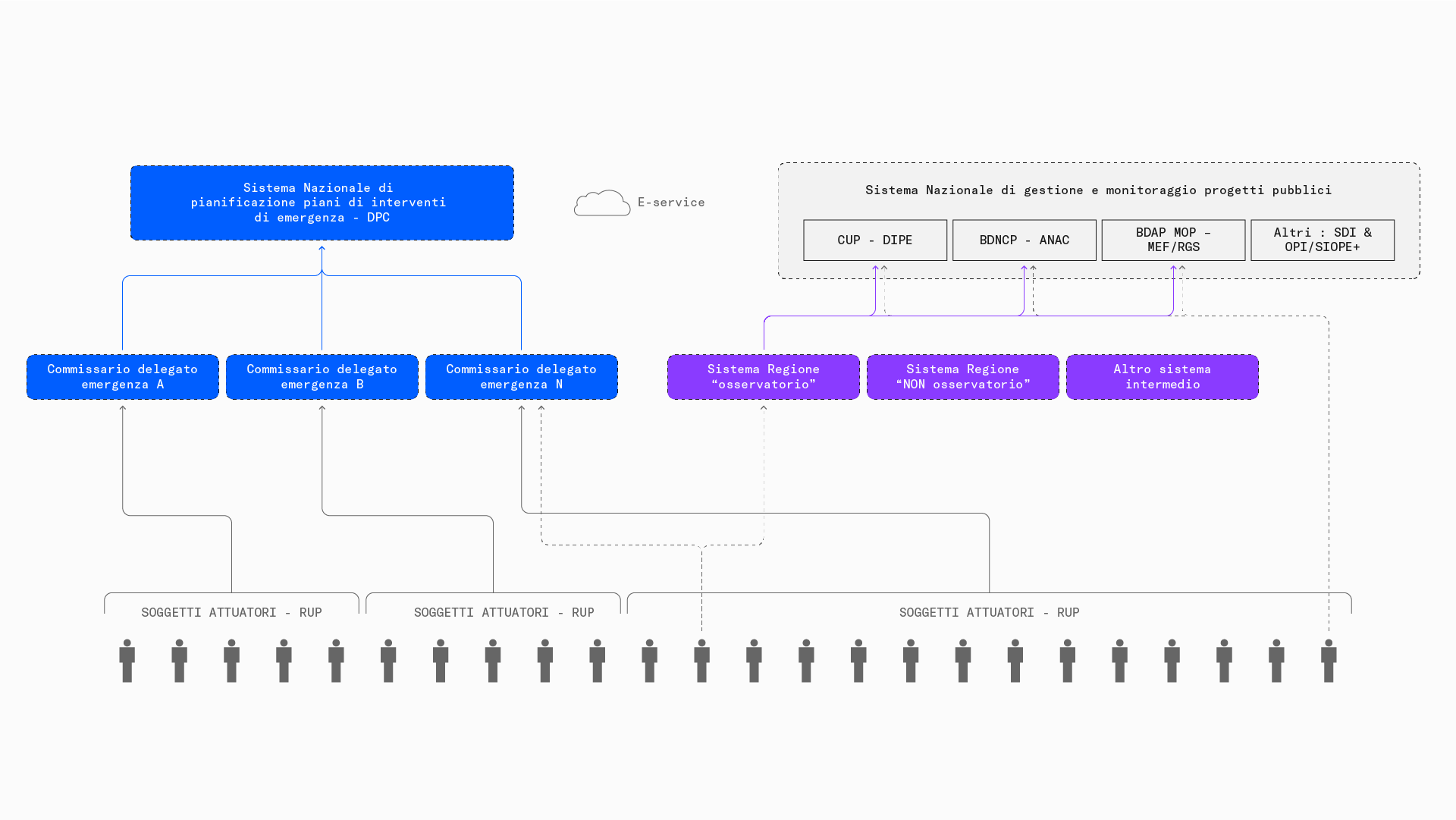
A unified information network for emergencies
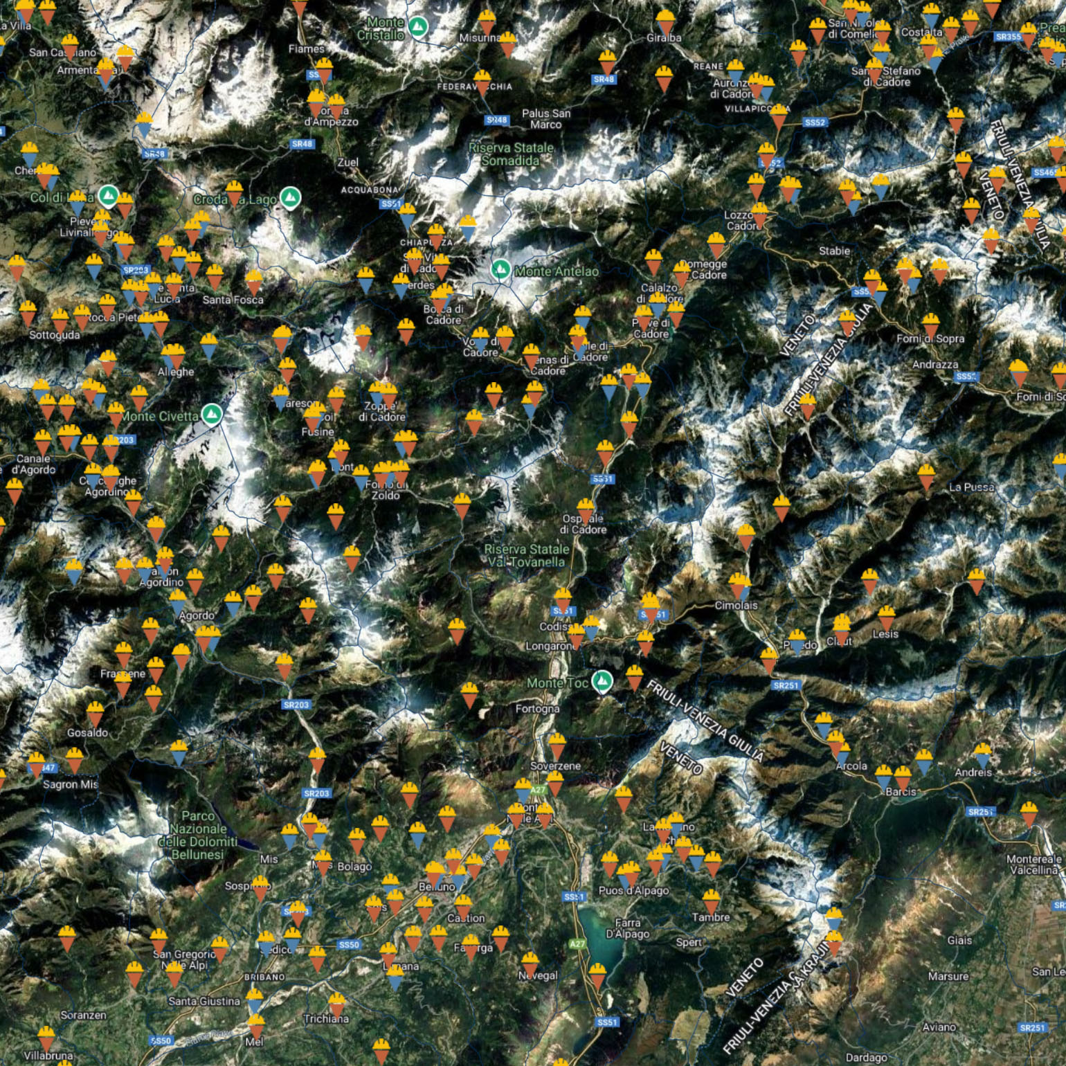
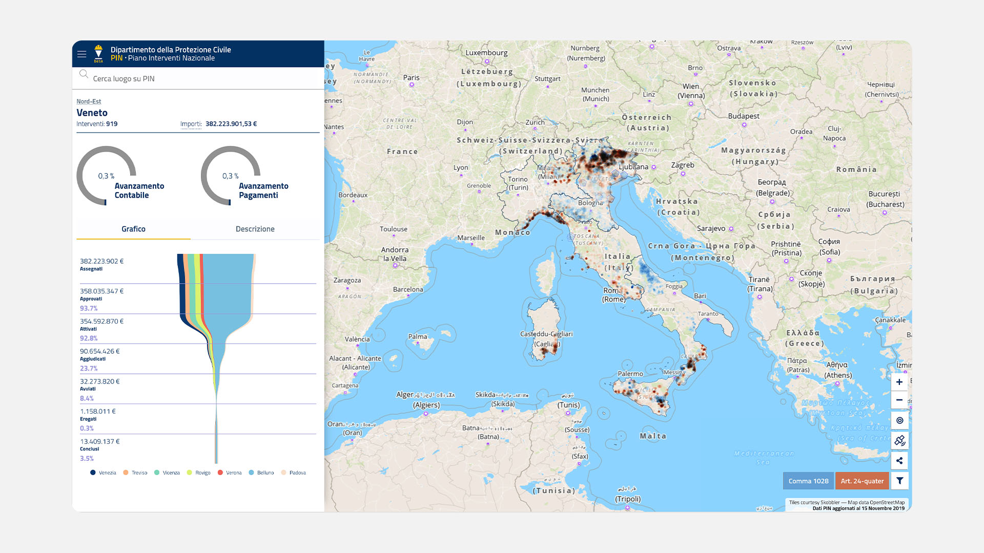
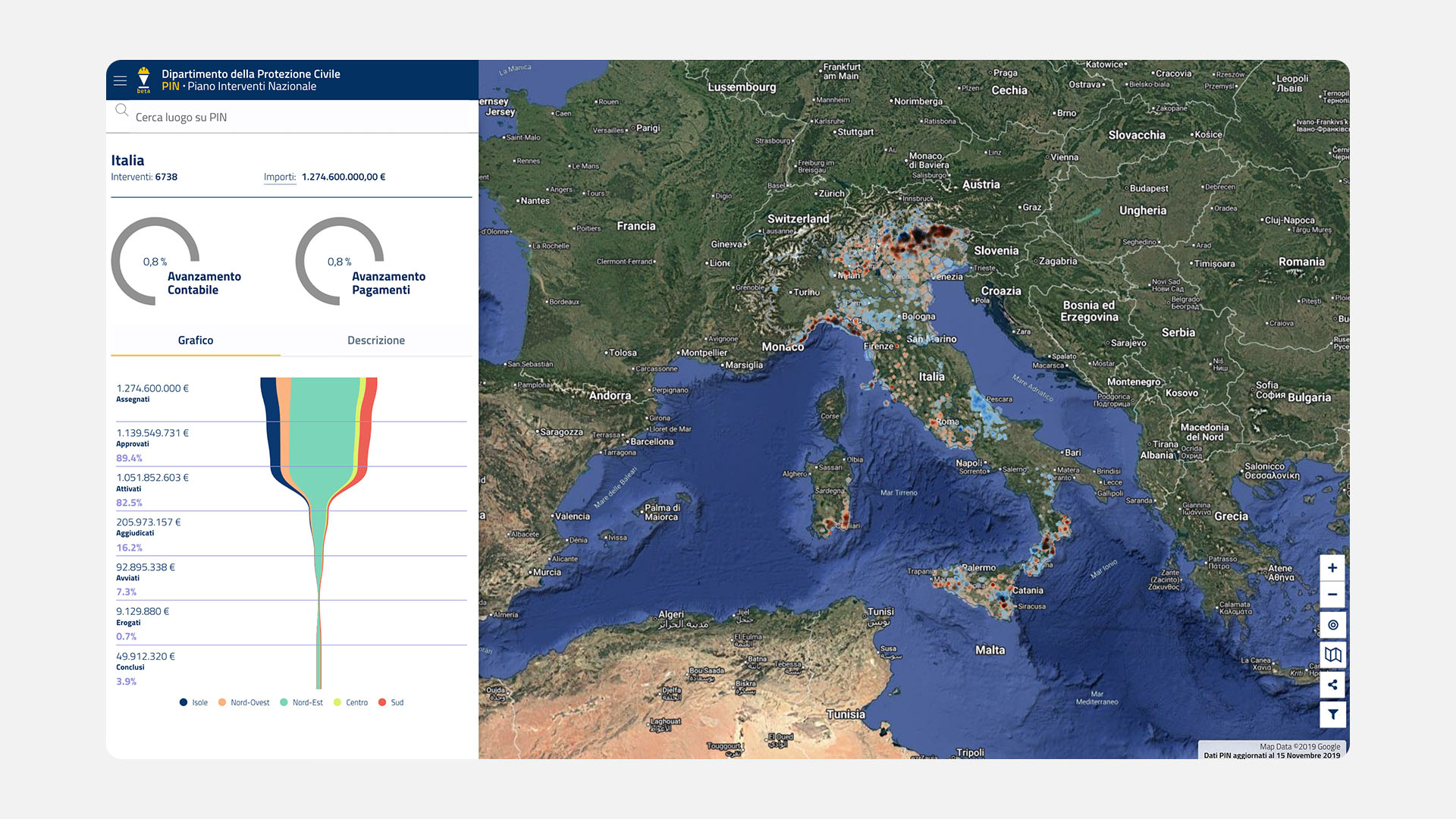
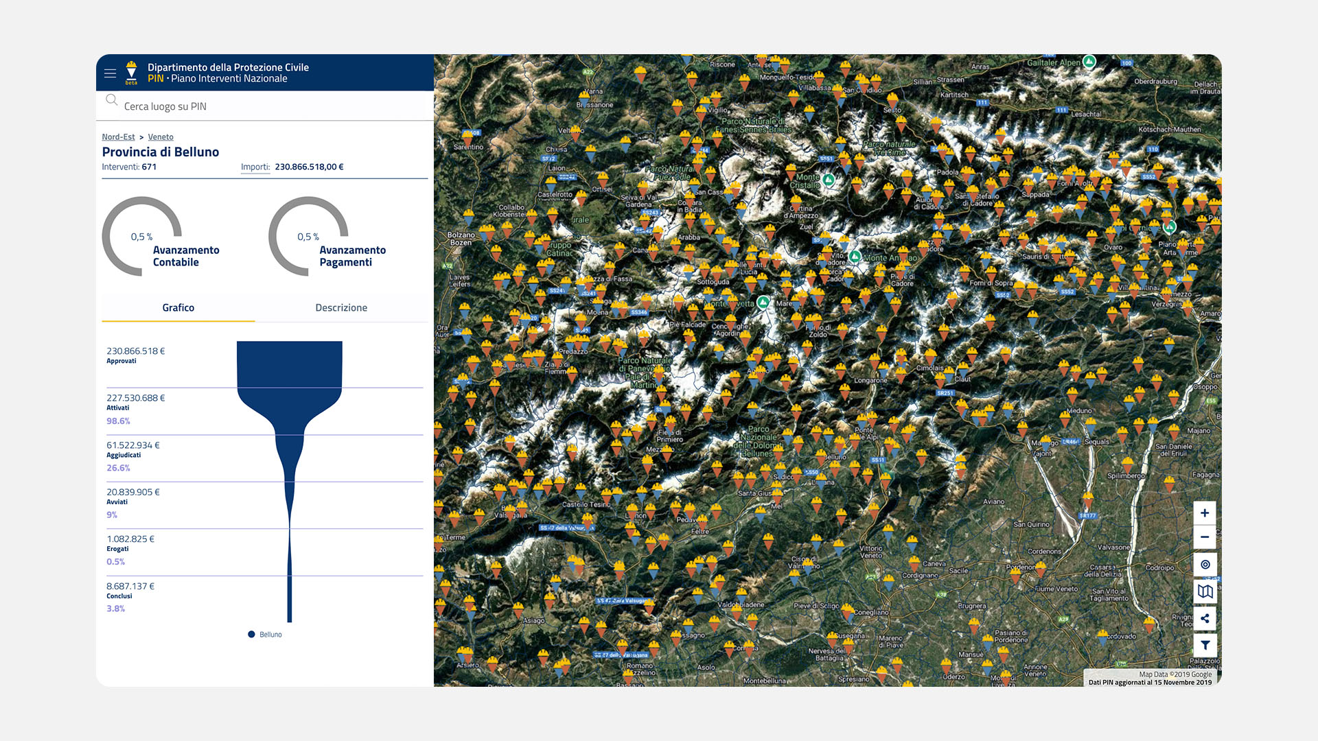
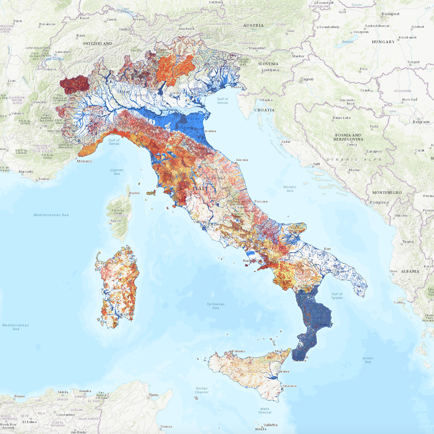
PIN aggregates data from heterogeneous sources in a single environment, simplifying the supervision of emergency plans. The platform allows users to view interventions on a map, check their progress, monitor spending, and access associated technical documentation. The system is fed in near real time by national databases and mass upload tools dedicated to regional operators.
A platform designed for Civil Protection
PIN is designed to meet the operational needs of the Commissioners and offices of the DPC. The system includes features for validating changes, reporting, automatic report generation, and administrative traceability. Each intervention is identified by a unique code and enriched with standardized metadata to facilitate management.
Technology enabling transparency and cooperation
Thanks to a scalable infrastructure based on REST architecture and federated services, PIN can communicate securely with other public systems. The GIS mapping component enables advanced spatial analysis, while interoperability modules reduce data duplication and improve information quality. The entire project was carried out in accordance with Designers Italia guidelines to ensure accessibility, reusability, and openness.
Digital, collaborative, replicable
PIN is a benchmark model for the digitization of emergency planning. The project combines technological innovation, administrative simplification, and public accountability, laying the foundations for more coordinated, transparent, and sustainable emergency management in Italy.
Your next solution could start here!
Let’s explore your needs and design the right way to turn data into value.
Contact usDiscover more about this service

Digital Platform
Tailored digital platforms, e-commerce, websites, and complex systems to connect people, processes, and growth opportunities.
Discover more
Neo geography
Territorial data visualization with maps, sensors, and interactive dashboards to understand, plan, and generate new connections.
Discover moreSelected projects
IdroGeo 2.0
National platform for monitoring and preventing hydrogeological instability.
Discover more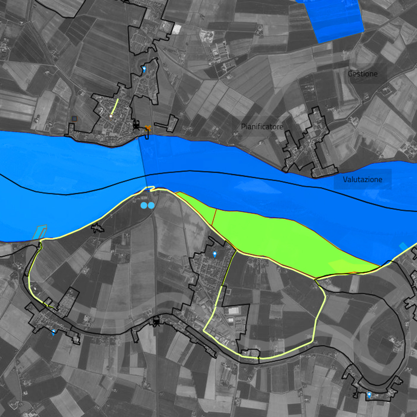
NapaGEO
The national digital platform for the geolocation of underground infrastructure activities.
Discover more