IdroGeo 2.0
Service
Digital Platform
Data & AI
Neo geography
Design & User Experience
Industry
Gov
A Digital Heritage for the Future
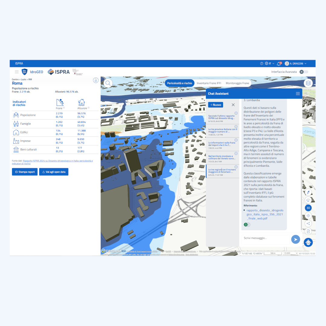
IdroGEO 2.0 transforms complex hydrogeological risk data into clear, navigable information, offering citizens, technicians, and institutions a unique tool for understanding and protecting the territory.
Customer challenges
- Need to integrate AI tools into the platform to provide extended assistance.
- Only partial interoperability between the different systems and datasets involved.
- The visualizations were very technical, non-interactive, and difficult to read.
- Access to data was mainly reserved for expert users, excluding citizens and local administrators.
- The infrastructure was neither scalable nor aligned with current public design guidelines.
- Communicating highly complex and large data sets publicly is not easy in terms of speed and user experience.
SciamLab solutions
- Integration of AI agents for immediate information retrieval on scientific and regulatory texts and data warehouses.
- Adoption of an open, API-first data architecture to ensure interoperability with regional systems, scalability, and reuse.
- Integration of 3D geospatial visualizations and scenario simulations.
- Complete interface redesign according to Designers Italia guidelines.
- Development of a multilingual, scalable, open-source platform.
- Access profiling and management for landslide inventory registry and monitoring system.
The project
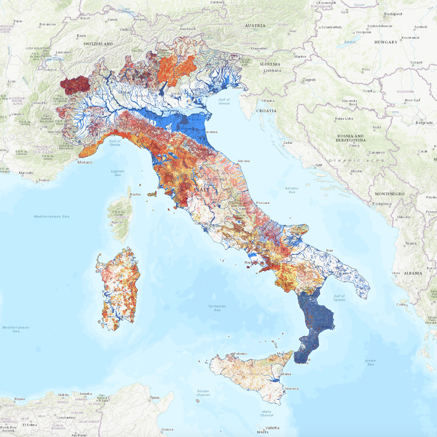
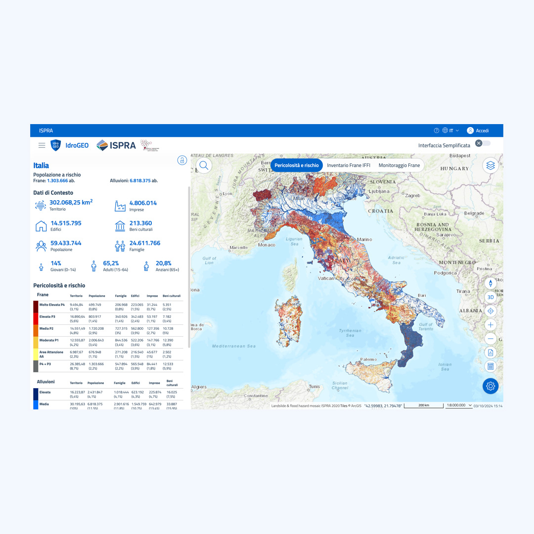
Conceived by ISPRA (Higher Institute for Environmental Protection and Research) and developed by SciamLab Srl, it provides access to the Inventory of Landslide Phenomena in Italy (IFFI), national hazard maps for landslides and floods, risk indicators, and the National Register of In Situ Landslide Monitoring Systems, making the information accessible and usable by everyone.
This is a significant innovation in public digital cartography, capable of raising national standards for map navigation. Thanks to an advanced interface and simplified access to geospatial data, IdroGEO is a point of reference for professionals, researchers, and public administrations. Its quality and functionality are comparable to the advanced cartographic solutions of major technology players, the result of substantial investments.
Innovation at the service of everyone
The main challenge was to make a technical tool packed with complex data accessible by developing an interface that met the usability and digital accessibility criteria defined by Designers Italia, while also extending it for map applications. Thanks to advanced solutions, the platform guarantees intuitive navigation and allows professionals, institutions, and citizens to easily consult complex data.
Through a scalable architecture and the use of open data and APIs, IdroGEO allows downloading and integration with regional systems, promoting collaboration, transparency, and data reuse. This makes it not only a reference for consultation, but also an open infrastructure for research, spatial planning, and hydrogeological risk management.
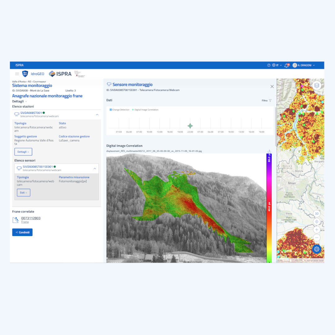
An Advanced User Experience for greater risk understanding
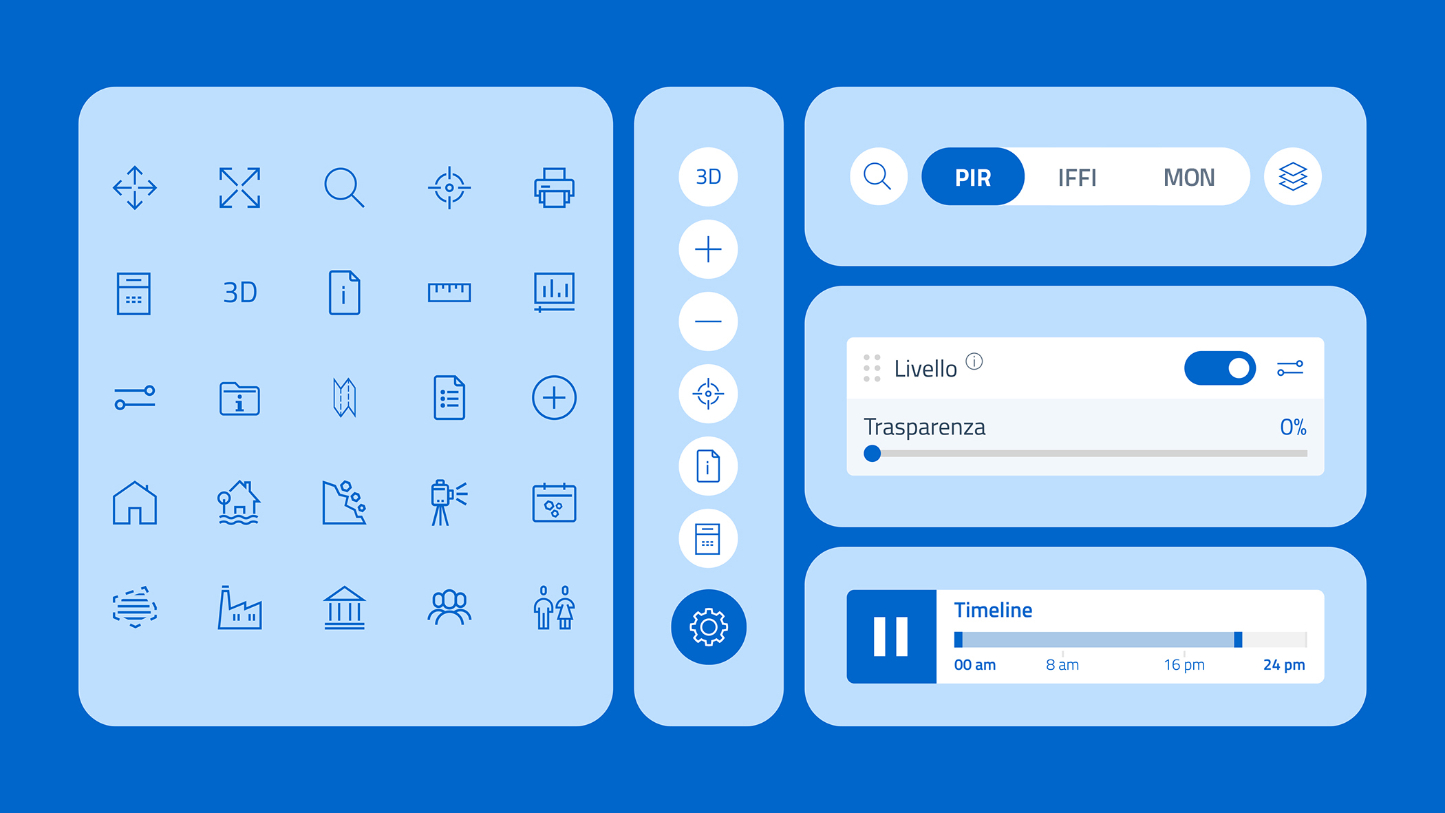
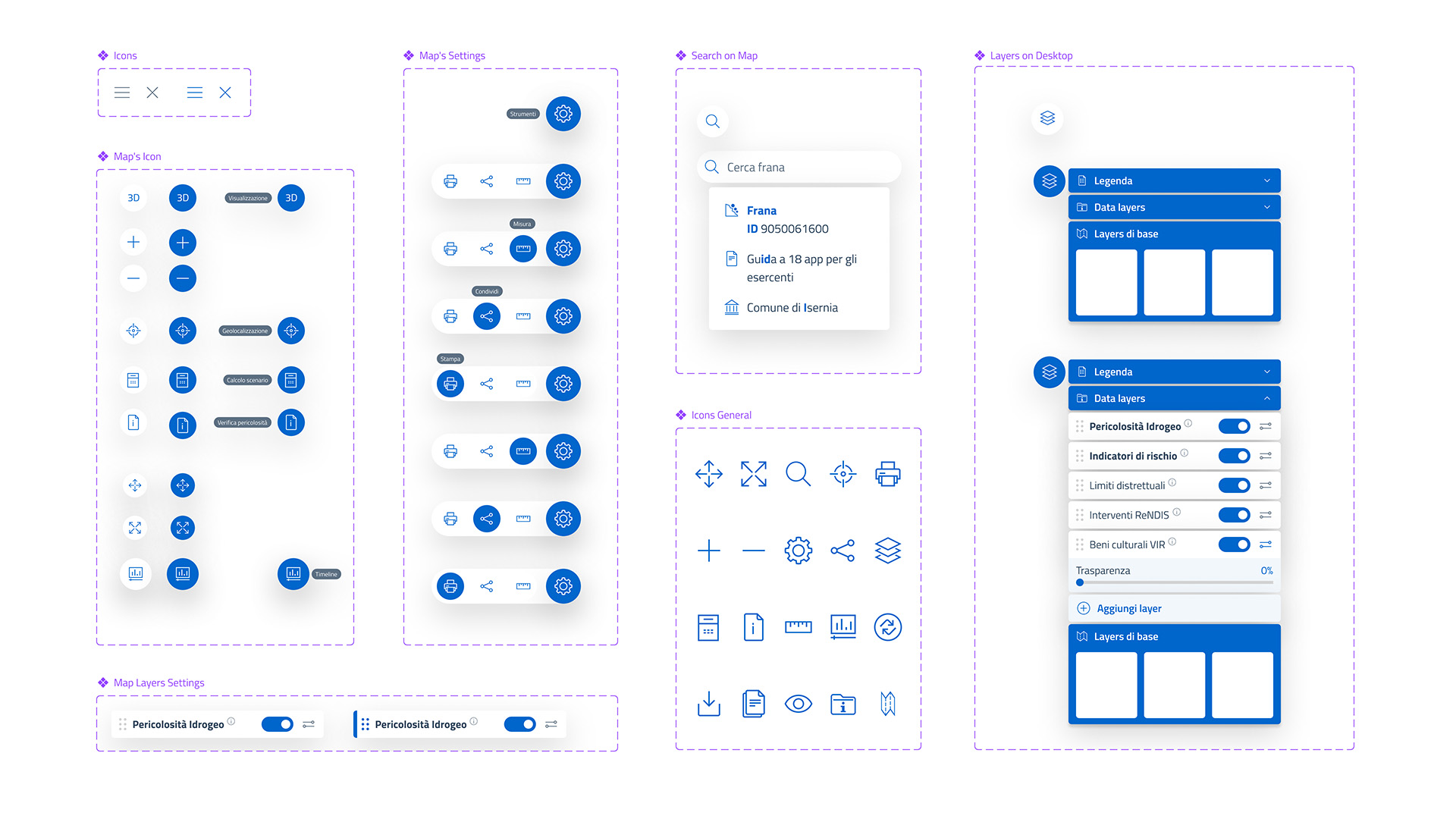
To improve the user experience, customized components have been developed, including:
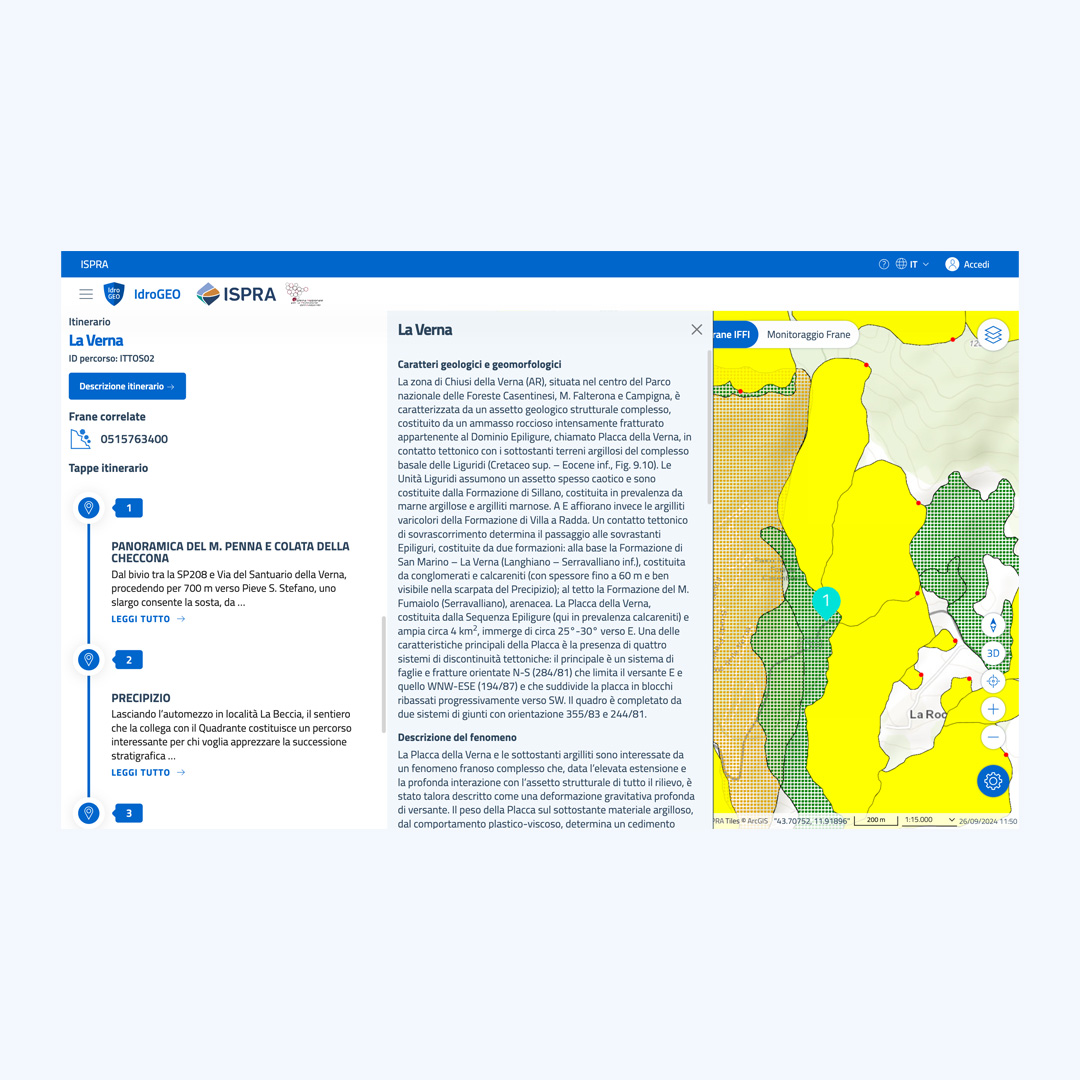
- Redesign of typical WebGIS functions tailored to the specific needs of the data to be represented
- Surface measurement and 3D elevation profile drawing for detailed territorial analysis
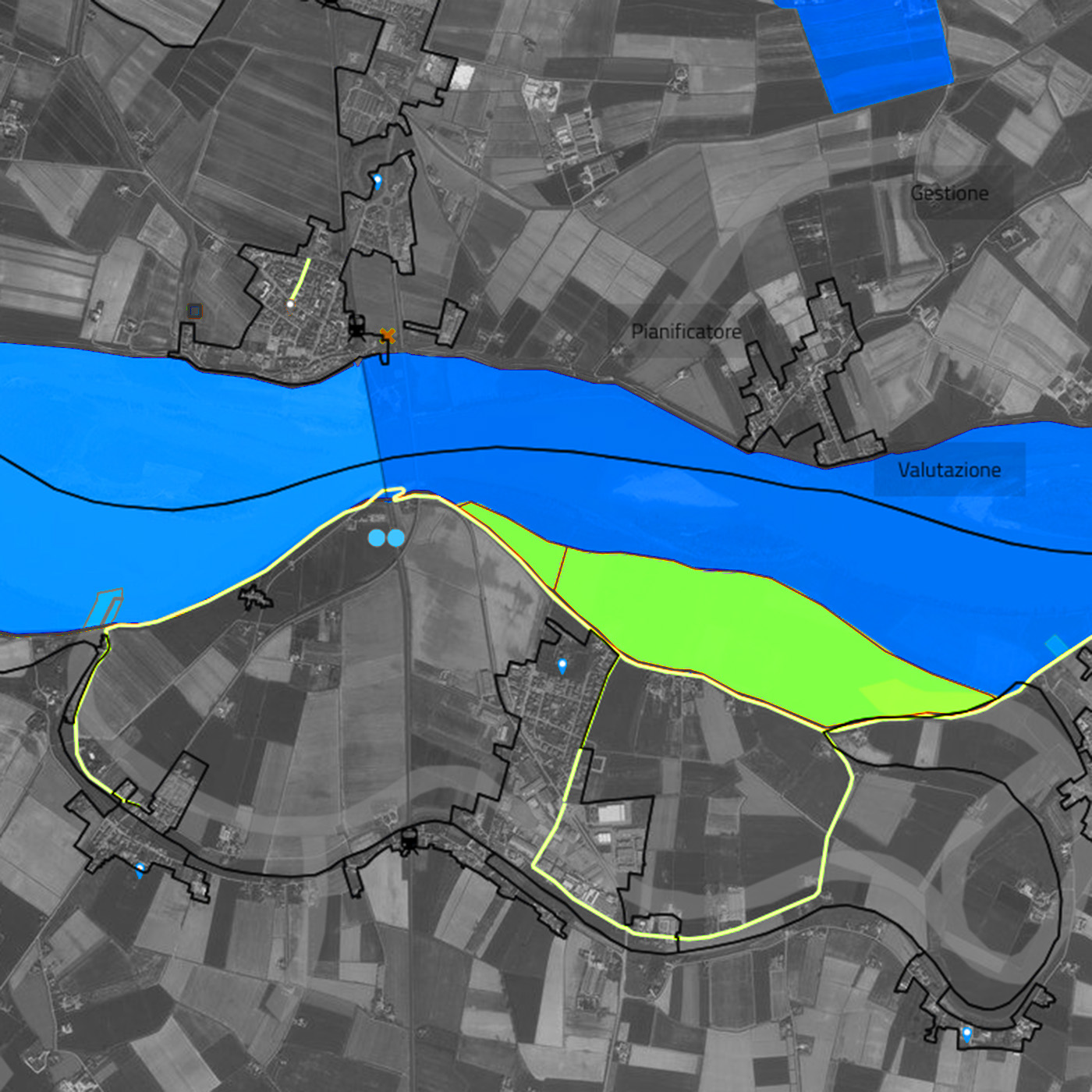
- 3D visualization for a better understanding of hydrogeological risk
- Simulation of risk scenarios in areas chosen by the user, for the estimation of exposed elements (e.g., population, buildings)
- Advanced map layer management to filter relevant data
- Visualization and access to sensor data from experimental sites within the Landslide Monitoring Network
These features transform hydrogeological instability into a more understandable and tangible concept, thanks to an inclusive approach that balances AgID design guidelines with the specific needs of the project.
A Digital Heritage for the Future
IdroGEO is much more than an innovative platform: it is a model of advanced digital public service. Most of the elements developed will be shared with the Designers Italia community, enriching the guidelines for interactive maps and encouraging reuse in other public administration projects.
This project demonstrates how technology, design, and open data can promote transparency, participation, and active citizenship, increasing citizens' awareness of the risk conditions of the territory in which they live, helping to prevent and mitigate risks, and contributing to building a safer future for all.
IdroGEO has been awarded with several prizes, including:
- ADI Design Index 2025
- Good Practice European Public Sector Award (EPSA) 2023-2024
- Premio PA Sostenibile e Resiliente - ForumPA 2021
Timeline
-
2020-Present
Live Website
Featured In
Your next solution could start here!
Let’s explore your needs and design the right way to turn data into value.
Contact usDiscover more about this service

Digital Platform
Tailored digital platforms, e-commerce, websites, and complex systems to connect people, processes, and growth opportunities.
Discover more
Data & AI
Custom AI solutions and data systems to analyze, predict, and automate, turning information into strategic value.
Discover more
Neo geography
Territorial data visualization with maps, sensors, and interactive dashboards to understand, plan, and generate new connections.
Discover more
Design & User Experience
Intuitive and accessible digital experiences, where aesthetics and functionality meet to simplify complexity and enhance user experience.
Discover moreSelected projects
NapaGEO
The national digital platform for the geolocation of underground infrastructure activities.
Discover more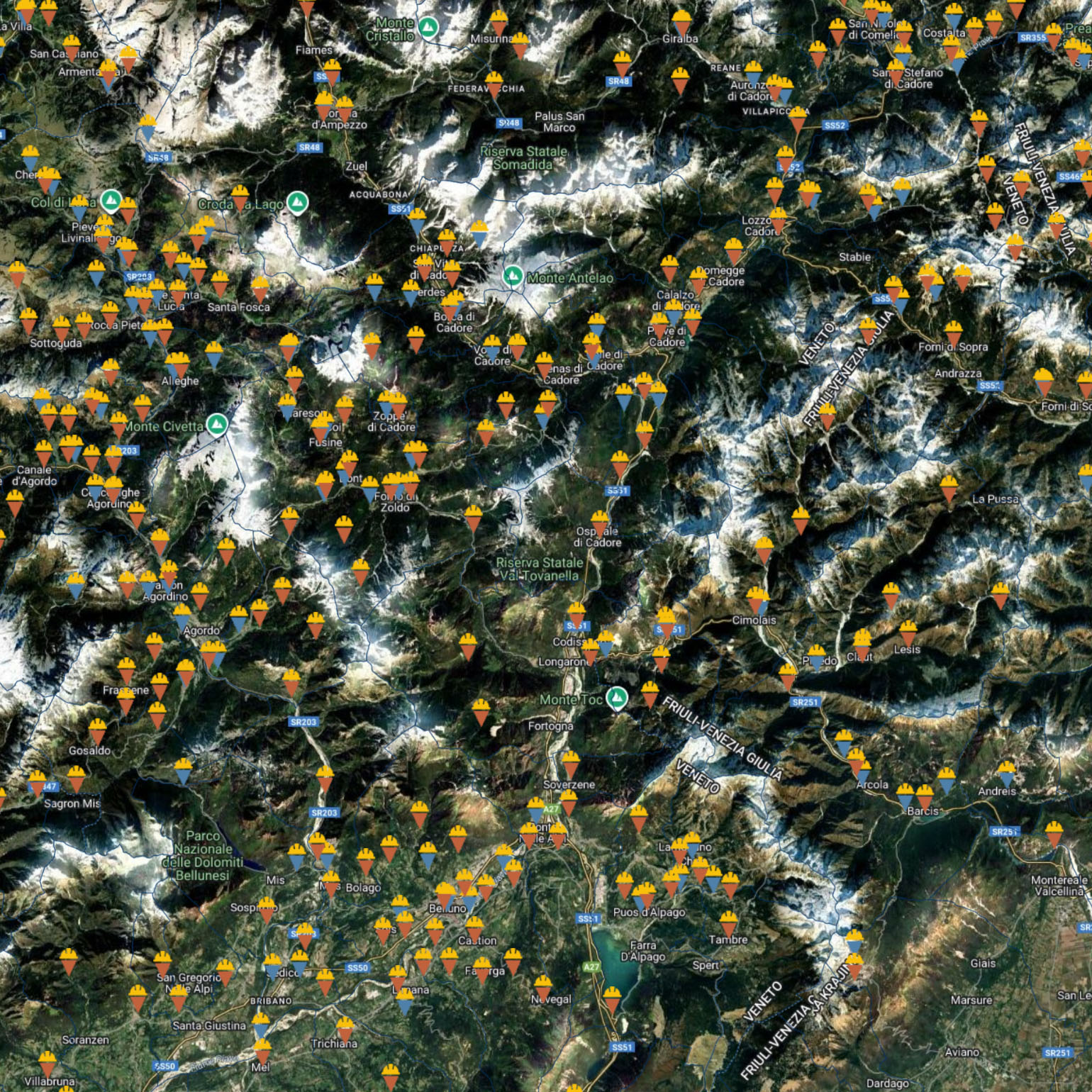
PIN
The digital platform to support the management, monitoring, and transparency of interventions funded by the Italian Government and managed by the Department of Civil Protection.
Discover more